Barcode:
1000289
Temporary housing for workers at Fairmont Reservoir Subjects:
Hills
Buildings
Trees
Dirt Roads
Collection: Bledsoe Collection 1908-1933
|
Barcode: 1000289 |
Title: Fairmont Reservoir
Description: Temporary housing for workers at Fairmont Reservoir Subjects: Hills Buildings Trees Dirt Roads Collection: Bledsoe Collection 1908-1933 |
 Barcode:
1000291 |
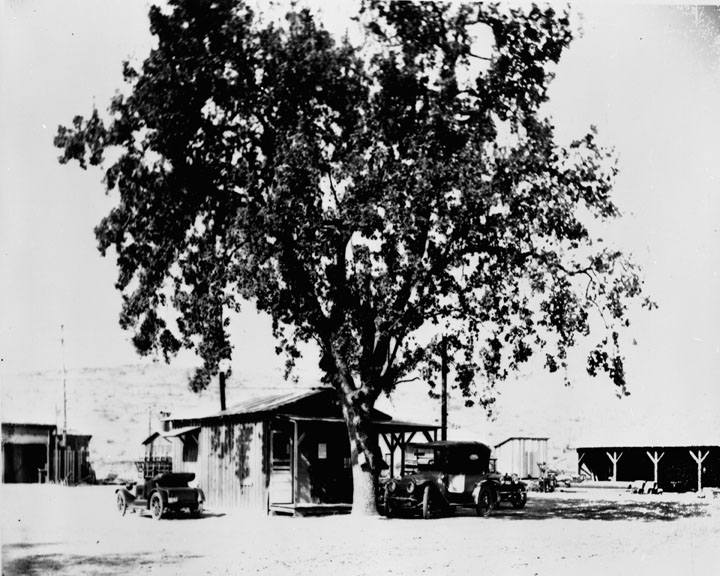
Title: Fairmont Reservoir
Description: Field headquarters at Fairmont Reservoir Subjects: Trees Buildings Automobiles Collection: Bledsoe Collection 1908-1933 |
 Barcode:
1000292 |
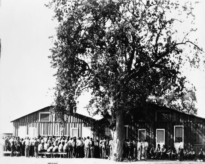
Title: Fairmont Reservoir
Description: Construction workers at Fairmont Reservoir Subjects: Men Buildings Trees Collection: Bledsoe Collection 1908-1933 |
 Barcode:
1000293 |
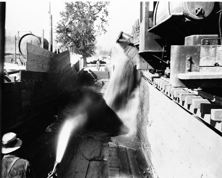
Title: Fairmont Reservoir
Description: Construction of Fairmont Reservoir The work on the Fairmont Reservoir has been under the direction of the engineer in charge of the construction of the Elizabeth Tunnel. As the lining of the Elizabeth Tunnel is now nearing completion the remaining construction work on the Fairmont Dam and other features of the reservoir have been placed in charge of the division engineer of the Mojave Division. Briefly stated, it is intended not only as a safeguard in the shape of a storage supply 200 miles from the intake, but also as a means for regulating the hourly fluctuation of water through the power plants located below, to meet peak load conditions. The capacity of the conduit into this reservoir is 420 cubic feet per second, but the outlet tunnel from the reservoir to the power plant has a capacity of 1,000 cubic feet per second. This will permit the discharge of this large volume of water in the few hours of the day during which the maximum demand exists for electric energy, and the decrease of the flow of water to a minimum amount during the night hours when the demand for power is relatively small. The mean discharge from the reservoir during the 24 hours of the day will be approximately 400 cubic feet per second. The excess capacity, above 400 second feet, of 20 cubic feet per second entering the reservoir is to enable the accumulation of water in this reservoir in case it should become necessary to draw it down and afterwards recover the available supply in the reservoir without interfering with the power output. The capacity of the Fairmont Reservoir at the 3,035 feet elevation is 7,620 acre feet. The dam will have a maximum center height of 115 feet and will contain 607,114 cubic yards. It will be built of earth with a concrete core-wall. The excavation from the northern half of the Elizabeth Tunnel has been put in the outer toes of the dam and amounts to 84,000 cubic yards. The core-wall will be carried up to the full height of the dam. There will be an outlet tower and regulating gates from the reservoir into the north end of the Elizabeth Tunnel. The Fairmont Reservoir will be to the advantage of both the Aqueduct Bureau and the Power Bureau and will be paid for jointly by them on a ratio which has not yet been decided upon. The Fairmont Tufa Mill is under the direction of the division engineer for the Mojave Division. The building of this mill has cost $26,666. Up to date there has been manufactured a this plant 218,755 barrels of tufa cement, and there is still 100,000 barrels to grind. The saving resulting from the use of the Fairmont tufa cement is 97 cents per barrel. The purpose of this tufa mill has been distinctly one of economy, although the product that has been turned out is as satisfactory as either the Colton, Riverside or Monolith Portland cement. The mill is located on the line of the work about 20 miles from the railroad, and by this regrinding process about 75 cents per barrel has been saved in transportation charges alone. A very satisfactory practical test has been made of the tufa cement in the building of 6 reinforced concrete siphons with this product. These siphons are 10 feet in diameter with a 9-inch shell, and are built for heads up to 75 feet. All but one of these pipes has been filled with water now for over 6 months, and has with-stood this pressure without leakage or injury. The entire water load apparently is being carried by the concrete and none of it by the reinforcing. Also the Elizabeth Tunnel, which is 26,870 feet long, has been entirely lined with tufa concrete. Some of this ground is very heavy, requiring close timbering with 10 by 10 sets. This concrete lining is satisfactory, and no cracks have been discovered in the entire length of the tunnel. A characteristic of the tufa cement, when made into standard sand briquettes, is that while it is slow in getting its initial hardness and requires from six to ten days to attain the strength of standard Portland cement, thereafter it continues to grow in strength, and exceeds the straight Portland cement. This hardening process continues for over a year’s time. Subjects: Railroad Tracks Men Trees Collection: Bledsoe Collection 1908-1933 |
 Barcode:
1000300 |
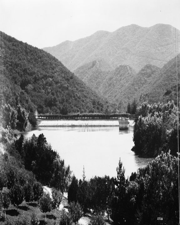
Title: Franklin Canyon Reservoir
Description: Upper Franklin Reservoir – located at Franklin Canyon Drive south of Mulholland Drive at Coldwater Canyon, Beverly Hills, it holds 38.572 million gallons of water it went into service February 1915 and went out of service in December 1982 Subjects: Mountains Water Trees Collection: Bledsoe Collection 1908-1933 |
 Barcode:
1000306 |
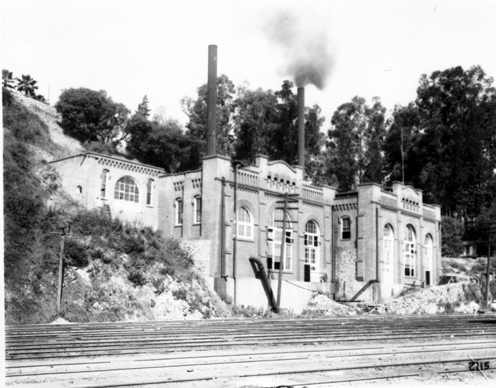
Title: Pumping Plants
Description: Buena Vista Pumping Plant - is located at the edge of Elysian Park, east of the North Figueroa Street Bridge, and faces the Los Angeles River. It is not known just how long a pumping plant has been in operation here, but records show Buena Vista was placed in operation by the Water Bureau in 1904. The original plant replaced a water wheel, located in the near vicinity. Buena Vista still operates every day in the year, its two steam and two electrically driven pumps being capable of supplying 29,000,000 gallons of water daily. It pumps water from Buena Vista to Solano and Highland Reservoirs. Subjects: Buildings Trees Collection: Bledsoe Collection 1908-1933 |
 Barcode:
1000314 |
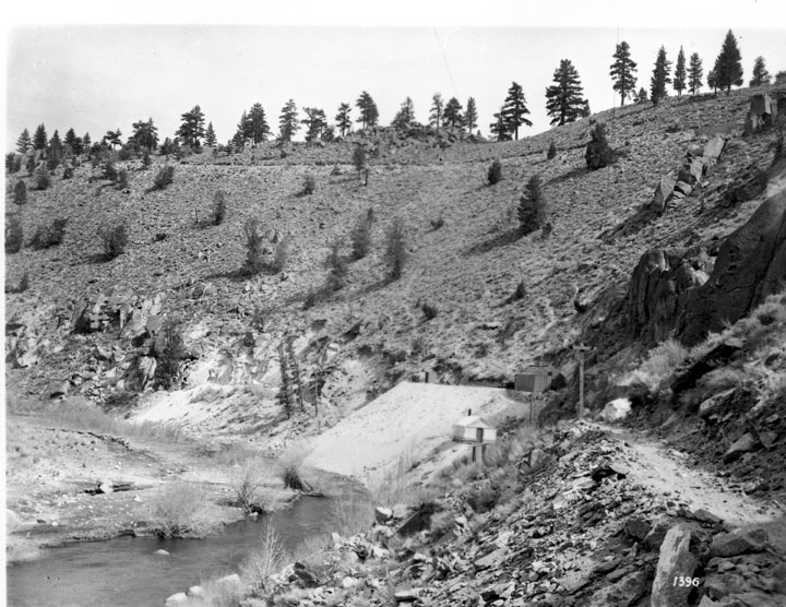
Title: Owens Valley Power Plants and Owens River Gorge
Description: Owens River Gorge near Casa Diablo Power Plant The Owens River Gorge is a steep 10 miles (16 km) canyon on the upper Owens River in eastern California. The canyon is located at the eastern edge of the Sierra Nevada Mountains in southern Mono County, along the stretch of the river where it exits the Long Valley near its source and enters the north end of Owens Valley. The gorge is a popular destination for rock climbing. The Owens River Gorge was formed when the Owens River cut through the Bishop Tuff: a layer of welded ash formed from the eruption of the long Valley Caldera. This erosion exposed the tuff layers, including rare columnar rhyolite formations. The Los Angeles Department of Water and Power constructed the Long Valley Dam at the head of the Owens River Gorge as part of a hydropower project in 1941, and completely dewatered the 16-km Lower Gorge reach from 1953 to 1991. Beginning in 1991, a limited range of flows has been released to re-water the reach, recreate riparian habitat, and re-establish a brown trout sport fishery while maintaining hydropower diversions. Subjects: Water Hills Trees Collection: Bledsoe Collection 1908-1933 |
 Barcode:
1000336 |
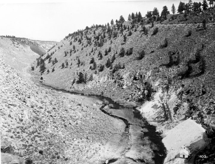
Title: Owens Valley Power Plants and Owens River Gorge
Description: Owens River Gorge The Owens River Gorge is a steep 10 miles (16 km) canyon on the upper Owens River in eastern California. The canyon is located at the eastern edge of the Sierra Nevada Mountains in southern Mono County, along the stretch of the river where it exits the Long Valley near its source and enters the north end of Owens Valley. The gorge is a popular destination for rock climbing. The Owens River Gorge was formed when the Owens River cut through the Bishop Tuff: a layer of welded ash formed from the eruption of the long Valley Caldera. This erosion exposed the tuff layers, including rare columnar rhyolite formations. The Los Angeles Department of Water and Power constructed the Long Valley Dam at the head of the Owens River Gorge as part of a hydropower project in 1941, and completely dewatered the 16-km Lower Gorge reach from 1953 to 1991. Beginning in 1991, a limited range of flows has been released to re-water the reach, recreate riparian habitat, and re-establish a brown trout sport fishery while maintaining hydropower diversions. Subjects: Hills Trees Collection: Bledsoe Collection 1908-1933 |
 Barcode:
1000356 |
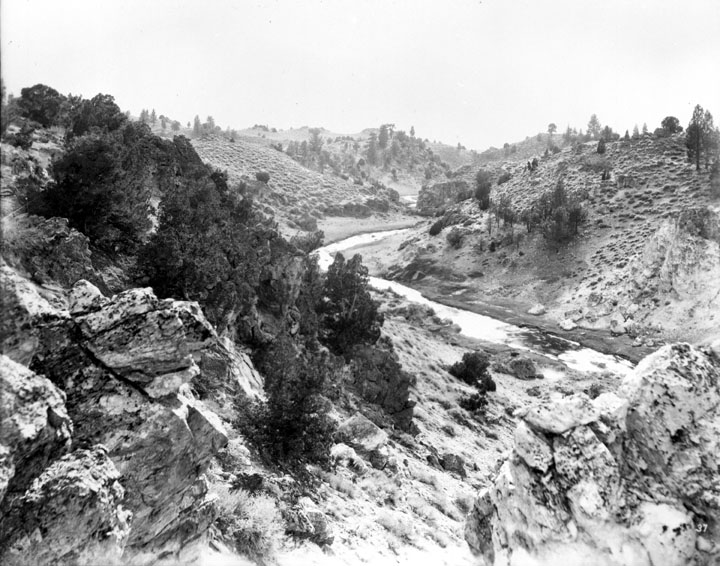
Title: Owens Valley Power Plants and Owens River Gorge
Description: Owens River The Owens River is a river in eastern California in the United States, approximately 120 miles (193.1 km) long. It drains into an arid ranching basin, called the Owens Valley, on the eastern side of the Sierra Nevada Mountains. The site of a long-running chapter of the bitter California Water Wars, the river drained into Owens Lake until it was entirely diverted for irrigation and drinking water. On December 6, 2006, the City of Los Angeles restored 5% of its post-aqueduct flow, by court order. The river rises in the Sierra Nevada in southwestern Mono County, approximately 20 miles (32.2 km) south of Mono Lake and 25 miles (40.2 km) east of Yosemite Village. It flows southeast across the Long Valley Caldera, through Lake Crowley reservoir, then descends through the 10 miles (16.1 km) Owens River Gorge, emerging at the north end of the Owens Valley north of Bishop. In the area around Bishop, it is diverted through many ditches to irrigate the surrounding farming region. It flows south-southeast through the Owens Valley between the Sierra Nevada on the west and the White and Inyo mountains on the east, past Big Pine. Approximately 10 miles (16.1 km) south-southeast of Big Pine, most of the remaining river is diverted into the Los Angeles Aqueduct, completed in 1913 to supply drinking water to Los Angeles. the remaining river flows in a trickle through the southern valley, flanked by the Los Angeles Aqueduct, past Lone Pine, entering the lake bed of now-dry Owens Lake at the southern end of the valley. The acquisition of water rights for the Los Angeles Aqueduct under the direction of William Mulholland was highly controversial and led to violence and sabotage by local residents in the 1920s. The diversion of water and the subsequent desiccation of Owens Lake remains highly controversial. The re-establishment of the lake has been a long-time goal of the California environmentalist community. Subjects: Hills Water Trees Collection: Bledsoe Collection 1908-1933 |
 Barcode:
1000388 |
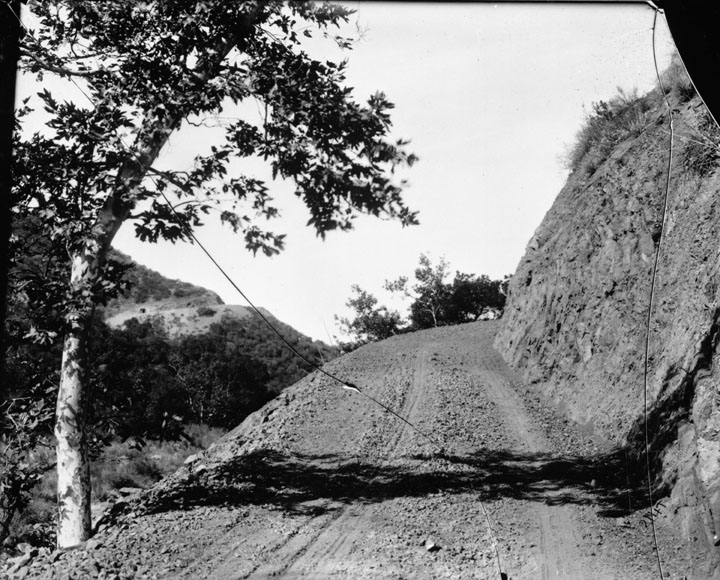
Title: San Francisquito Canyon Power Plant No. 1
Description: Road, San Francisquito Canyon Subjects: Roads Hills Trees Collection: Bledsoe Collection 1908-1933 |