34 Records Found

Barcode:
1000465

Title:  Owens Valley Power Plants

Description:
Cottonwood Creek spilling into the aqueduct - Cottonwood Creek flows from the 14,000 foot-high alpine fens (bogs) of the White Mountains eastward into the Great Basin desert. It is the largest drainage in the largest remaining unprotected roadless area in California. The creek cascades preipitously down a steep canyon, past aspen groves and through willow and cottonwood woodlands teeming with migratory songbirds.

Subjects:
Water
Bridges
Hills
Reinforced Concrete Construction

Collection:  Bledsoe Collection 1908-1933


Barcode:
1000714

Title:  Haiwee Reservoir

Description:
Haiwee Reservoir

These reservoirs serve two important functions. They provide a natural purification to the aqueduct water before it enters an enclosed series of pipes, tunnels and conduits which convey it to the City. This natural purification occurs as the water is exposed to fresh air and intense desert sunshine during its long, slow passage through the 7 mile long reservoirs. The reservoirs also serve a regulatory function since they can retain inflow during shutoffs of the aqueducts downstream or sustain flows into these aqueducts if the canal north of Haiwee is out of service. The Second Aqueduct begins here as a separate facility and is supplied by a new outlet which can also supply the First Aqueduct. The two reservoirs were originally one with a dam at each end. They were separated during construction of the Second Aqueduct to increase operational flexibility. North Haiwee has a high water elevation of 3,761 feet and a capacity of 12,245 acre feet. South Haiwee, 3,744 feet and a capacity of 29,648 acre feet.

Subjects:
Water
Bridges

Collection:  Padilla Collection 1908-1935


Barcode:
1000753

Title:  Hollywood Reservoir

Description:
Spillway, upper Hollywood Reservoir - Upper Hollywood Reservoir built in Weid Canyon above the main Hollywood Reservoir was completed and placed in service March 1933.

Built as a stand-by storage basin, the reservoir is of earth fill construction 80 feet maximum height with a capacity of 192 acre-feet or more than sixty-two million gallons.

At the upper end of the reservoir is Hollywood Knolls pumping plant which serves the higher areas with water. Eventually, it will pump water to Hollywoodland and nearby sections. Water will be pumped from this plant to tanks above 1,100 feet elevation.

Maximum depth of the water in Upper Hollywood Reservoir in front of the dam is 61 feet at elevation 751.5. The top area at high water will contain 8.54 acres.

Construction of the Upper Hollywood Dam was undertaken as a result of action of the Board of Water and Power Commissioners authorizing H. A. Van Norman, chief engineer and general manager of the Bureau of Water Works and Supply, to build the reservoir as part of the general plan for the supplying of water to the Hollywood area.

Many tests were made to determine the density of the foundation material in place and its degree of compaction. Density and compaction tests also were made on the rolled fill placed in the reservoir dam. Supervision and inspection of the rolled earth fill work and the placing of concrete in the 45-inch outlet line under the dam was maintained.

In connection with the reservoir construction it was necessary to build a road around the lake tying into the main road leading from lower Hollywood Reservoir.

Upper Hollywood Reservoir was several months in the making. Engineers engaged in the work under Mr. Van Norman and William W. Hurlbut, were C. E. Angilly, R. R. Proctor and H. L. Jacques.

Subjects:
Reservoirs
Water
Bridges
Hills

Collection:  Padilla Collection 1908-1935


Barcode:
1000755

Title:  Hollywood Reservoir

Description:
Upper Hollywood Reservoir - bridge leading to outlet tower in new Upper Hollywood Reservoir. From this bridge one obtains an attractive panoramic view of both reservoirs which lie in the bowl formed by the hills that rise above Weid Canyon in Hollywood

Subjects:
Reservoirs
Water
Hills
Bridges

Collection:  Padilla Collection 1908-1935


Barcode:
1000756

Title:  Hollywood Reservoir

Description:
Upper Hollywood Reservoir - bridge leading to outlet tower in new Upper Hollywood Reservoir. From this bridge one obtains an attractive panoramic view of both reservoirs which lie in the bowl formed by the hills that rise above Weid Canyon in Hollywood

Subjects:
Reservoirs
Water
Hills
Bridges

Collection:  Padilla Collection 1908-1935


Barcode:
1000774

Title:  Upper Franklin Canyon Reservoir

Description:
Upper Franklin Reservoir – located at Franklin Canyon Drive south of Mulholland Drive at Coldwater Canyon, Beverly Hills, it holds 38.572 million gallons of water it went into service February 1915 and went out of service in December 1982

Subjects:
Reservoirs
Bridges
Water

Collection:  Padilla Collection 1908-1935


Barcode:
1000778

Title:  Lower Franklin Canyon Reservoir

Description:
Lower Franklin Reservoir – located at 1300 N. Beverly Drive, Beverly Hills, it holds 67.109 million gallons of water is a earth filled dam with asphalt concrete lined, and is covered. It went into service November 1982

Subjects:
Reservoirs
Bridges
Water
Hills

Collection:  Padilla Collection 1908-1935


Barcode:
1000786

Title:  Dry Canyon Reservoir

Description:
Dry Canyon Reservoir

Subjects:
Reservoirs
Water
Hills
Bridges

Collection:  Padilla Collection 1908-1935


Barcode:
1000864

Title:  Los Angeles River

Description:
Los Angeles River

Los Angeles River, the unpredictable! She has changed her name, often has she changed her course, and many times has she changed the topography of the land she flows through.

The first mention of our river by the white man is found in Fray Juan Crespi’s diary under the date of August 2, 1769. Fray Crespi was the diarist for the famed Portolá expedition that left San Diego, the first white settlement in California, July 14, 1769.

The expedition wended its way north by land to establish a settlement upon Viscaino’s Bay of Monterey, discovered but not settled 160 years previously. Nor did Portolá settle or find Monterey Bay, but went past its latitude to become the discover of San Francisco Bay.

After a weary march north from San Diego, Don Gaspar de Portolá’s party, consisting of 64 men, which included 27 leather-jacketed soldiers (soldados de cuera) under Rivera y Moncada, and six Catalan volunteers under Pedro Fages, with the Franciscan Father Crespi to record events, arrived on August 1 in the Arroyo Seco, about where Sycamore Grove is today. There they camped for the night.

The following morning, the march had resumed for about a league and a half when they came upon a beautiful river, where, due to its being August 2, the day for the great Indulgence of Our Lady of Los Angeles de Porciúncula, they stopped for the day that every man might receive the Atomement, and named the river Porciúncula. This was out Los Angeles River, and the spot they camped on was about where Broadway crossed the river today.

Since the entry in Fray Crespi’s diary is descriptive as well as highly prophetic, a quotation of the day’s entry is merited, as it is the first description ever given of the river or of the Los Angeles district:

Wednesday, August 2, 1769. We set out from the valley in the morning and followed the same plain in a westerly direction. After traveling about a league and a half through a pass between low hills, we entered a very spacious valley, well grown with cottonwoods and alders, among which ran a beautiful river from north northwest, and then doubling the point of the steep hill, it went on afterwards to the south. Towards the north northeast there is another river bed which forms a spacious water course, but we found it dry. (Arroyo Seco) This bed unites with that of the river, giving clear indication of great floods in the rainy season, for we saw that it had many trunks of trees on the banks. We halted not very far from the river, which we named Porciúncula. Here we felt three consecutive earthquakes in the afternoon and night. We must have traveled about three leagues today. This plan where the river runs is very extensive. It has good land for planting all kinds of grain and seeds, and it’s the most suitable site of all we have seen for a mission, for it has all the requisites for a large settlement.

Little did he realize how “large” a “settlement” would one day be here. But he continues:

August 3. At half past six we left the camp and followed the Porciúncula River which runs down the valley, flowing through it from the mountains into the plain. After crossing the river we entered a large vineyard of wild grapes and infinity of rose bushes in full bloom. Fray Crespi’s report was undoubtedly the reason for the founding of the Pueblo de Nuestra Senora la Reina de Los Angeles, 12 year later, on the Rio Porciúncula, September 4, 1781. The first settlers immediately tapped the river with the Zanja Madre, and from that day on white men watched the moods of the Los Angeles River, wondering what new quirk she would take, and when.

According to the early Spanish records, our river behaved herself pretty well for the first 30 years or more of the life of the town. Through rains were often heavy, the growth of willow thickets in the river bottom from well into San Fernando Valley down to and beyond the lower limits of the pueblo tended to check its flow short of flood proportions.

The year 1815, however, was one never to be forgotten in the pueblo for, due to the heavy and continuous rains (it rained for 10 days and 10 nights without intermission), the river overflowed and changed its bed. The river moved over nearer the Plaza, running along the present North Spring Street (old San Fernando Street) to Alameda and down that thoroughfare to about First and Los Angeles Streets, down Los Angeles to Ninth Street, then west to Figueroa and down Figueroa and over to the ocean, where Playa del Ray is now located.

The Plaza was flooded to a depth of several inches, and the old Indian village of Yang Na that had stood for centuries was a sea of floating wickiups.

This flood not only changed the course of the river but also changed the location of the Plaza, which then stood about a block and a half northwest of the present Plaza. Governor Sola, in 1818, selected a location on higher ground and the Plaza was moved to its present site.

Another great flood in 1825 carried the Rio de Los Angeles back to its present bed and changed its outlet to the sea from its old course through the Ballena Rancho, or Ballona as it was more commonly called, to its present course into the bay at Wilmington.

This flood drained the marshlands between the pueblo and San Pedro, and caused the forests of sycamores and oaks, then growing abundantly, to disappear.

Besides cutting a definite channel to tidewater, the flood caused a union of our river with the San Gabriel River, just north of Cerritos Rancho, and they flowed together into San Pedro Bay until 1867, when the San Gabriel formed a new channel into Alamitos Bay.

In 1832, floods changed the drainage around the Compton district and dried up the few remaining lagoons. From then until the American occupation, the Los Angeles River behaved itself pretty well.

Subjects:
Water
Bridges
Electrical Apparatus

Collection:  Padilla Collection 1908-1935


Barcode:
1000866

Title:  Los Angeles River

Description:
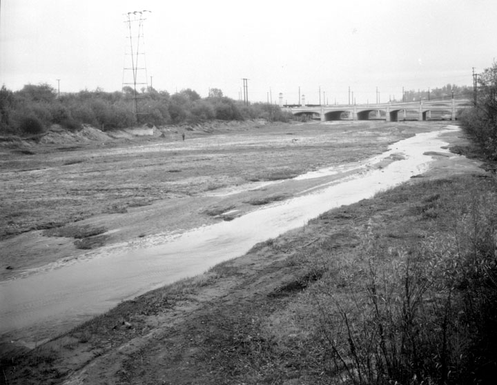
Los Angeles River at Fletcher Drive

Los Angeles River, the unpredictable! She has changed her name, often has she changed her course, and many times has she changed the topography of the land she flows through.

The first mention of our river by the white man is found in Fray Juan Crespi’s diary under the date of August 2, 1769. Fray Crespi was the diarist for the famed Portolá expedition that left San Diego, the first white settlement in California, July 14, 1769.

The expedition wended its way north by land to establish a settlement upon Viscaino’s Bay of Monterey, discovered but not settled 160 years previously. Nor did Portolá settle or find Monterey Bay, but went past its latitude to become the discover of San Francisco Bay.

After a weary march north from San Diego, Don Gaspar de Portolá’s party, consisting of 64 men, which included 27 leather-jacketed soldiers (soldados de cuera) under Rivera y Moncada, and six Catalan volunteers under Pedro Fages, with the Franciscan Father Crespi to record events, arrived on August 1 in the Arroyo Seco, about where Sycamore Grove is today. There they camped for the night.

The following morning, the march had resumed for about a league and a half when they came upon a beautiful river, where, due to its being August 2, the day for the great Indulgence of Our Lady of Los Angeles de Porciúncula, they stopped for the day that every man might receive the Atomement, and named the river Porciúncula. This was out Los Angeles River, and the spot they camped on was about where Broadway crossed the river today.

Since the entry in Fray Crespi’s diary is descriptive as well as highly prophetic, a quotation of the day’s entry is merited, as it is the first description ever given of the river or of the Los Angeles district:

Wednesday, August 2, 1769. We set out from the valley in the morning and followed the same plain in a westerly direction. After traveling about a league and a half through a pass between low hills, we entered a very spacious valley, well grown with cottonwoods and alders, among which ran a beautiful river from north northwest, and then doubling the point of the steep hill, it went on afterwards to the south. Towards the north northeast there is another river bed which forms a spacious water course, but we found it dry. (Arroyo Seco) This bed unites with that of the river, giving clear indication of great floods in the rainy season, for we saw that it had many trunks of trees on the banks. We halted not very far from the river, which we named Porciúncula. Here we felt three consecutive earthquakes in the afternoon and night. We must have traveled about three leagues today. This plan where the river runs is very extensive. It has good land for planting all kinds of grain and seeds, and it’s the most suitable site of all we have seen for a mission, for it has all the requisites for a large settlement.

Little did he realize how “large” a “settlement” would one day be here. But he continues:

August 3. At half past six we left the camp and followed the Porciúncula River which runs down the valley, flowing through it from the mountains into the plain. After crossing the river we entered a large vineyard of wild grapes and infinity of rose bushes in full bloom. Fray Crespi’s report was undoubtedly the reason for the founding of the Pueblo de Nuestra Senora la Reina de Los Angeles, 12 year later, on the Rio Porciúncula, September 4, 1781. The first settlers immediately tapped the river with the Zanja Madre, and from that day on white men watched the moods of the Los Angeles River, wondering what new quirk she would take, and when.

According to the early Spanish records, our river behaved herself pretty well for the first 30 years or more of the life of the town. Through rains were often heavy, the growth of willow thickets in the river bottom from well into San Fernando Valley down to and beyond the lower limits of the pueblo tended to check its flow short of flood proportions.

The year 1815, however, was one never to be forgotten in the pueblo for, due to the heavy and continuous rains (it rained for 10 days and 10 nights without intermission), the river overflowed and changed its bed. The river moved over nearer the Plaza, running along the present North Spring Street (old San Fernando Street) to Alameda and down that thoroughfare to about First and Los Angeles Streets, down Los Angeles to Ninth Street, then west to Figueroa and down Figueroa and over to the ocean, where Playa del Ray is now located.

The Plaza was flooded to a depth of several inches, and the old Indian village of Yang Na that had stood for centuries was a sea of floating wickiups.

This flood not only changed the course of the river but also changed the location of the Plaza, which then stood about a block and a half northwest of the present Plaza. Governor Sola, in 1818, selected a location on higher ground and the Plaza was moved to its present site.

Another great flood in 1825 carried the Rio de Los Angeles back to its present bed and changed its outlet to the sea from its old course through the Ballena Rancho, or Ballona as it was more commonly called, to its present course into the bay at Wilmington.

This flood drained the marshlands between the pueblo and San Pedro, and caused the forests of sycamores and oaks, then growing abundantly, to disappear.

Besides cutting a definite channel to tidewater, the flood caused a union of our river with the San Gabriel River, just north of Cerritos Rancho, and they flowed together into San Pedro Bay until 1867, when the San Gabriel formed a new channel into Alamitos Bay.

In 1832, floods changed the drainage around the Compton district and dried up the few remaining lagoons. From then until the American occupation, the Los Angeles River behaved itself pretty well.

Subjects:
Roads
Buildings
Bridges
Hills

Collection:  Padilla Collection 1908-1935


Please note, these photos are from the collections of the Los Angeles Department of Water and Power; they are not a Library collection. For information about or access to the collection, , please contact Angela Tatum (Department of Water and Power) at 213-367-8906.

New Search

Powered by DB/Text WebPublisher, from Inmagic WebPublisher PRO