 Barcode:
1000862
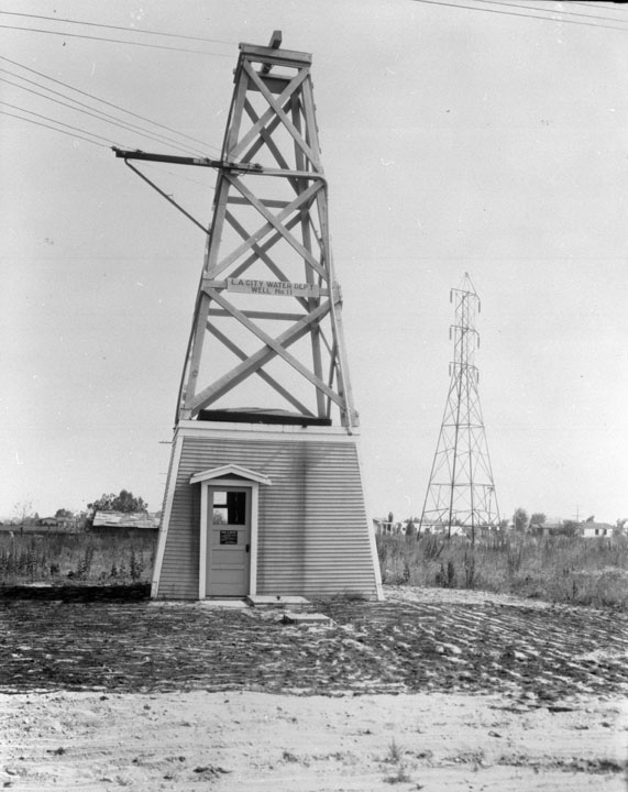
LADWP Well No. 11 Subjects:
Wells
Electrical Apparatus
Collection: Padilla Collection 1908-1935
|
Barcode: 1000862 |
Title: DWP Wells
Description: LADWP Well No. 11 Subjects: Wells Electrical Apparatus Collection: Padilla Collection 1908-1935 |
 Barcode:
1000863 |
Title: DWP Wells
Description: Drilling for wells Subjects: Wells Men Drilling Collection: Padilla Collection 1908-1935 |
 Barcode:
1001978 |
Description: Typical well in Owens Valley Beginning about 3 million years ago, the Sierra Nevada and White Mountains fault systems became active with repeated episodes of slip earthquakes gradually producing the impressive relief of the eastern Sierra Nevada and White Mountain escarpments that bound the northern Owens Valley-Mono Basin region. Owens Valley is a graben; a down dropped block of land between two vertical faults. Owens Valley is the westernmost graben in the Basin and Range Province. The western flank of much of the valley has large moraines coming off the Sierra Nevada. These unsorted piles of rock, boulders and dust were bulldozed to where they are by glaciers during the last ice age. An excellent example of a moraine is on California Highway 168 as it climbs into Buttermilk Country. This graben was formed by a long series of earthquakes, such as the 1872 Lone Pine earthquake, that have moved the graben down and helped move the Sierra Nevada up. The graben is in fact much larger than the depth of the valley infers; gravity studies suggest that 10,000 feet (3 km) of sedimentary rock mostly fills the graben and that a very steep escarpment is buried under the western length of the valley. The topmost part of this escarpment is exposed at Alabama Hills. The Sierra Nevada casts the valley in a rain shadow, which make Owens Valley “the land of little rain”. The valley was inhabited in late prehistoric times by the Timbisha (also called Panamint or Koso) in the extreme south end around Owens Lake and by the Eastern Mono (also called Owens Valley Paiute) in the central and northern portions of the valley. The Timbisha speak a Uto-Aztecan language related to Shoshoni and Comanche. The Eastern Mono speak a dialect of the Mono language which is also Uto-Aztecan, but is more closely related to Northern Paiute. The Timbisha presently live in Death Valley at Furnace Creek although most families also have summer homes in the Lone Pine colony. The Eastern Mono live in several colonies from Lone Pine to Bishop. In 1845 John C. Fremont named the Owens valley, river and lake for Richard Owens, one of his guides. Owens Valley is the arid ranching valley of the Owens River in southeastern California. The valley is approximately 75 miles (120 km) long, trending north-south, and is bounded by the Sierra Nevada on the west and the Inyo and White Mountains on the east. The mountains on either side (including Mount Whitney) reach above 14,000 feet (4,300 m) in elevation, while the floor of the Owens Valley is at 4,000 feet (1,200 m), making the valley one the deepest in the United States. The bed of Owens Lake, now a dry alkali flat, sits on the southern end of the valley. The valley provides water to the Los Angeles Aqueduct, the source of one-third the water for Los Angeles, and is infamous as the scene of one of the fiercest and longest running episodes of the California Water Wars. The Owens Valley stretches from Haiwee Reservoir in the south to the Sherwin Summit in the north (just north of the town of Bishop). Other towns in the Owens Valley include Lone Pine, Independence and Big Pine. The major road in the valley in US Highway 395. Subjects: Mountains Utility Poles Wells Collection: DWP Photo Collection |